As the East Coast braces for a blizzard and strong winter storm, Utahns will have to wait a couple more days before receiving any precipitation.
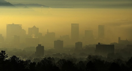
According to the National Weather Service, high pressure inversions will build in Utah valleys Thursday and Friday, deteriorating air quality and increasing fog and haze before a Saturday storm.
The NWS recommends carpooling, using public transportation, reducing idle time in vehicles and lowering thermostats to help reduce inversion pollution.
The Division of Air Quality predicts that air in Salt Lake and Davis counties will be unhealthy for sensitive groups Thursday and Friday, and will be moderate in Utah, Weber, Box Elder, Cache and Tooele counties.